Mountain #26: Mount Defiance (4960 feet)
10 August 2013
Mileage: 12 miles
Elevation gain: 4800 feet
Time: 3:20 to summit, an hour on top, 3:20 down, with a stop at Warren Lake
Temperature: humid, around 70
Partners: Brian Hamilton, Maisie and Kenzie
Do NOT attempt this hike without Tecnu! (and, okay, a strong heart)
I don’t know what gave me the bee in my bonnet to try out this hike, but once I saw that it has a 4800-foot elevation gain, I was determined to hike it. Mount Defiance. 4800 feet up. Six million-year-old shield volcano (according to web research; take with a grain of salt). Gotta have some of those in my 40-mountain year. Brian was willing to try it out with me, and, since his dogs wanted an outing, too, Brian even offered to drive. So, he picked me up at 6 a.m. (actually 5:55. Unlike me, he’s never late.), and we drove up to the Columbia River Gorge, to the Starvation Creek Trailhead, which has its own exit off I-84.
We were on the trail by 9:03 (or so). The first section of trail runs back west along the Jersey barriers lining I-84, then it ducks down into the woods on the Historic Columbia River Highway. Quickly, we passed three waterfalls: Cabin Creek, Hole in the Wall on Warren Creek, and Lancaster Falls, where we met the Starvation Ridge trail. We continued up the Mount Defiance trail (#413).
The trail traveled west along some rocky slopes (natural talus or the result of I-84 construction?) with challenging footing, lined with poison oak, then it turned seriously uphill and into the trees. The first 1400 feet of elevation gain happen fast on this trail. Switchback after switchback. I felt great, though. All of the hikes last week with Leslie (all of my previous 25 mountains this year!) helped, and Brian eventually said to me, “Okay, I’ll meet you at the junction with the trail to Warren Lake.†I must have seemed like a springer spaniel puppy right then, eager and energetic.
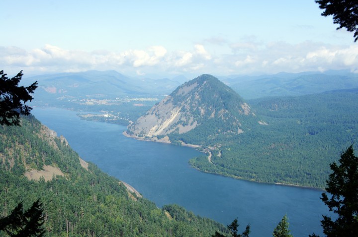
Down the Columbia from the Mount Defiance Trail
So I bounded uphill, not rushing but not stopping, quickly becoming soaking wet with the exertion and the day’s humidity. Eventually I passed Marc and Keith, two trail runners; but not much running can occur on this section of trail. Shortly, Marc caught me; and we chatted as the trail became much more doable. Instead of running, he told me stories about his short-lived military life and adventuring with his wife. From about 2200 feet to 4000 feet, the trail travels uphill in a more reasonable fashion, vine maples filling in the forest understory. There are even some runnable sections of trail. We walked.
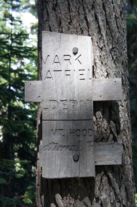
After we passed into a sliver of Mark O. Hatfield Wilderness (the summit is again outside the Wilderness), the trail broke out of the trees near some cliffs at about 4100 feet. The mist glided up over the cliffs. We moved into the trees, which at this point felt very alpine. The trail became talus-y, purple penstemon sprouted from between the rocks, and we found many ripe huckleberries! We saved at least a few for the next folks to pass.
We headed past the junction with the trail that leads east to Warren Lake, then we took the unlikely-looking trail that travels around the west side of the mountain at the next junction. That trail was quite rocky, so the going was slow, but we had great views of Mt. Adams and Mt. St. Helens. Our steps sounded musical as we clinked the fist- and foot-sized rocks together under our feet. We hit one more junction at the south end of the mountain, then headed uphill to the summit, where we found five other people and a whole boatload of radio towers and associated paraphernalia. There used to be a fire lookout up there, too. There still is four-wheel drive road to the top. The folks at the summit told us we’d just missed an ultrarunner who was summiting Mt. Defiance four times today, from the bottom. She was training for a race in the Alps. Brian later said she blew by him when he was at the trail junction to Warren Lake.
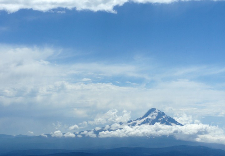
Mount Hood
Marc and I took some photos and got some calories in. I was hoping Brian would join me at the summit, because it has great views of Hood and nice boulders for resting. Just as I was feeling like I should probably head down to meet Brian at our scheduled meeting spot, a hiker asked if I was Julie. He proceeded to tell me that Brian was right behind him. Kenzie, Maisie, and Brian summited, and Kenzie and Maisie even begged some beef jerky out of the very nice man who’d heralded their arrival.
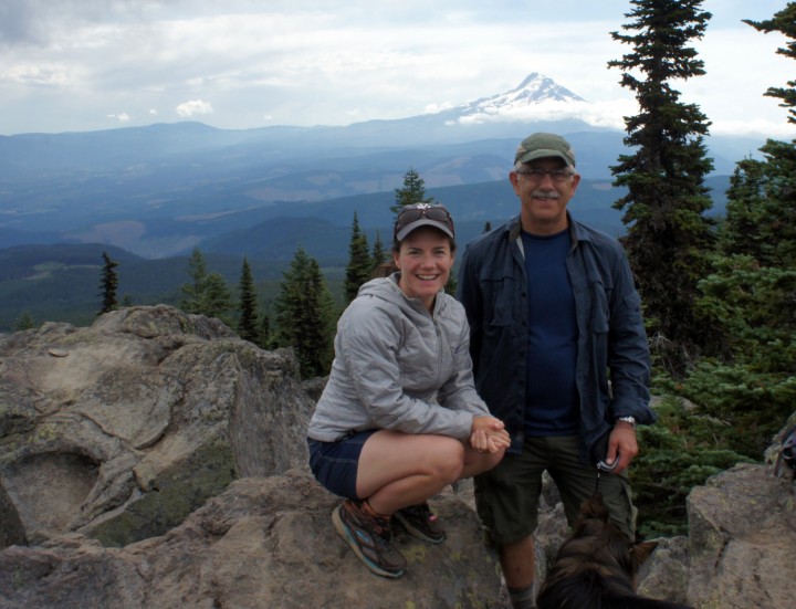
Julie, Brian, and Kenzie atop Mount Defiance, with Mount Hood in the background
Then we headed down off the north end of the mountain; and we proceeded down to Warren Lake, where the dogs were very happy to go for a swim, lap up some water, then roll in the dirt. At the next trail junction, we headed left and north down a lovely mellow section through large conifers with huckleberry understory. After we passed through an old, growing-back clearcut rampant with magenta-blooming fireweed, we ran into the ultrarunner, heading back uphill—the correct way on the loop, as it turns out. With some research, I found out she was Amy Sproston, no slouch in the ultrarunning world.
And, just as I was beginning to wonder what everyone meant about the steepness of this trail, we joined the Starvation Ridge trail, #414, and plummeted down along the ridge. The gravel turned to ball bearings under my shoes more than once, bouncing me onto my bum. I don’t recommend this as a descent. It would be straight uphill the other way, but I’d surely prefer that. I do recommend the trail, especially at the bottom, but not for kids or dogs (and definitely not without Tecnu; I’m hoping for the best). Near the end of the ridge, the trail breaks out of the trees and hangs over I-84, switchbacking tantalizingly close to the edge. The trail through the meadow is lined with poison oak. Then, with a quick descent through some trees with more ball-bearing trail, we were back on the Historic Columbia River Highway.
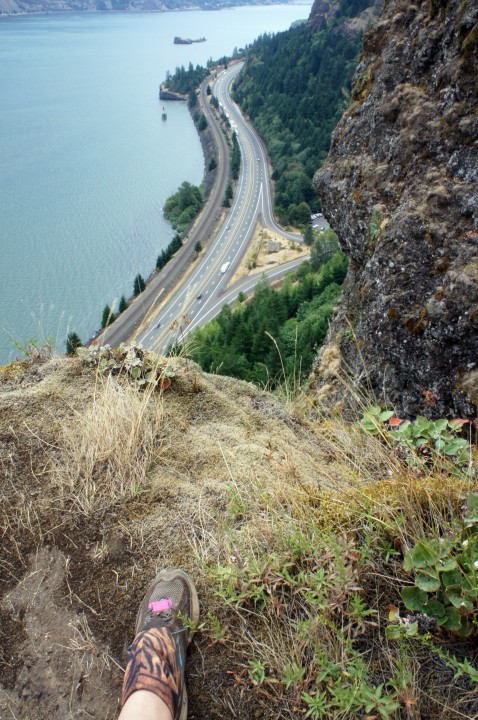
Please don’t take your children or dogs or unstable house guests on this trail
I bathed in the bathroom, grateful for soap and water, paranoid about urushiol. Three hours and a stop at Burgerville later (Walla-Walla onion rings, cherry-chocolate shake, halibut sandwich!), and I was home! Thank you, Brian and pups, for a fun and successful day.
Awesome day! Wonderful narration. Great shots! Like being there without the ball bearings, hope the poison oak juice stayed on the mountain. Thank you for sharing such a day.